

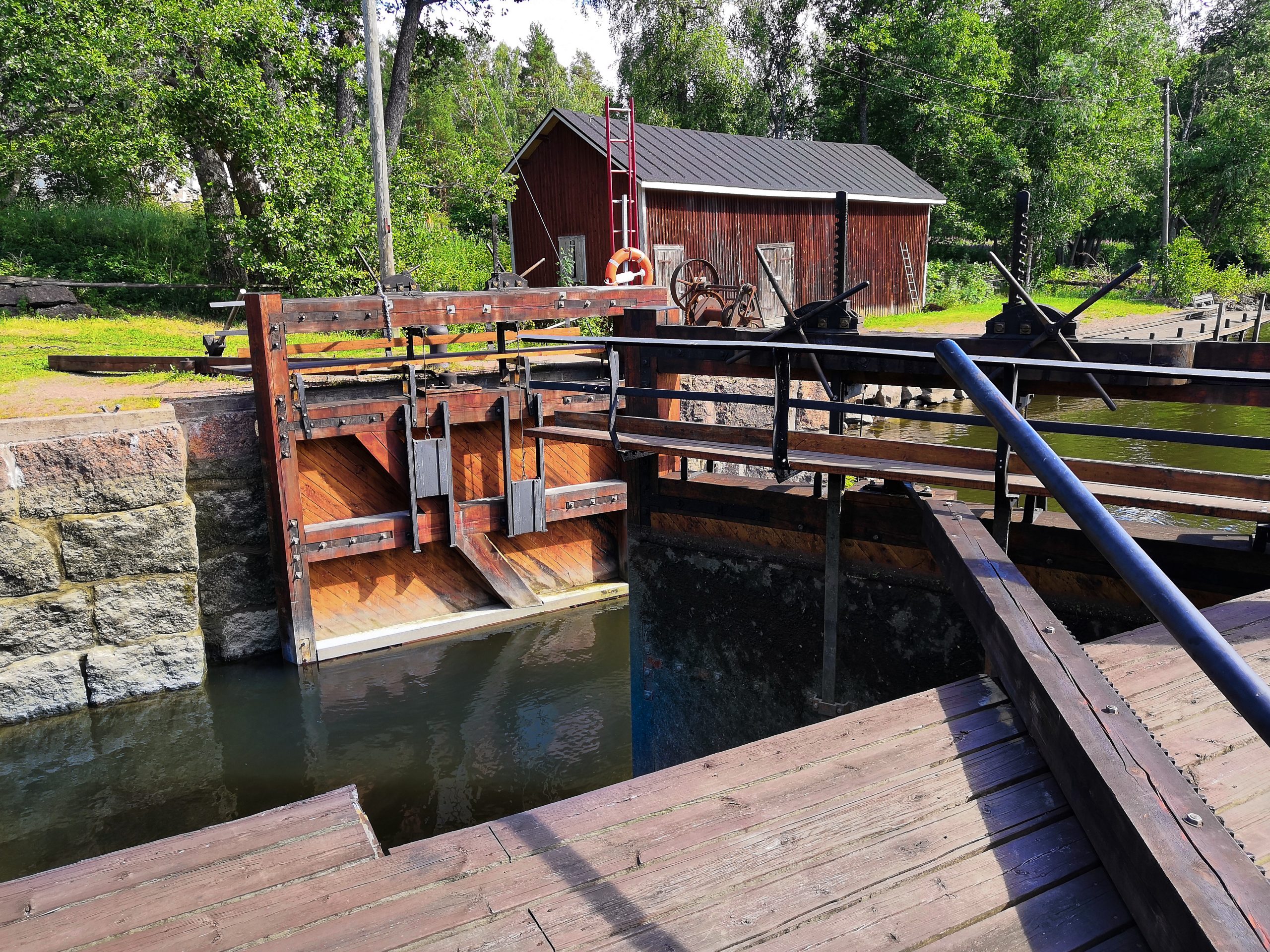
The Struka locks on the Pyhtää branch of the Kymi river were built in the early 20th century near a place where local monks used to fish for salmon, to serve barge traffic to the Stockfors factory. They are now the only manually operated locks in Finland. Operating on a self-service principal, these popular locks are freely available to boaters, enabling access from the Gulf of Finland all the way to the centre of Pyhtää.
The Struve Geodetic Arc is a chain of survey triangulation measurements stretching from the Arctic Sea to the Black Sea. It was used to determine the Earth’s shape and size by measuring the length of one meridian over a distance as long and as far to the north as possible. Measurements were made under the guidance of 19th century astronomer F.G.W. Struve.
The Struve Geodetic Arc was added to the list of Unesco World Heritage Sites in 2005, as a representative of scientific and technology cultural heritage. Of the 34 survey points selected as World Heritage Sites, six are located in Finland – and one of them is on Mustaviiri island in Pyhtää. The Mustaviiri point was measured and marked in the rock in 1833.
The measurement points are not only historically important, but also excellent lookout points. An observation tower is located next to the Mustaviiri point, with stunning views of the Gulf of Finland National Park. The best way to get to Mustaviiri island is by your own boat, or by charter boat.
Did you find what you were looking for?